The rehabilitation of the reed lake, a swamp that had become eutrophicated in the Culișer meadow, located in Salonta, Bihor county, has been carried out in the past 3 years within our project based on cross-border public-private partnership.
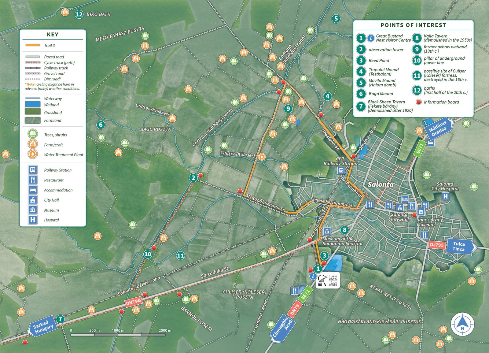
Trail 3 (circular route): Bygone Treasures Hidden in the Puszta

Learn about the landscape elements and human settlements which either no longer exist, or had been transformed so dramatically that nowadays they are barely perceptible.
| Distance: | 12 km |
| Duration: | about 4hrs10’ (on foot) / 1h50’ (by bicycle) |
| Means of transport: | on foot, by bicycle |
| Starting point: | Great Bustard Nest visitor centre |
| Via: | water treatment plant |
| Destination point: | Great Bustard Nest visitor centre |
| Download track: | Trail 3 [kmz] Trail 3 [gpx] |
Even if these landscape elements and old settlements do not exist nowadays, they appear on old maps, which is why we invite you to treat them as treasures waiting to be discovered.
 Highlights and points of interests:
- >> Swamps, grasslands and forests
- >> Earth mounds - the monuments of the puszta
- >> The canal system and landscape transformation
- >> Pusztas - the estates of Salonta
- >> Crofting life
- >> Herders, brigands, betyárs, outlaws
Watercolour by Arthur Heyer // Source: OSZK MEK
Salonta (Romanian) - Nagyszalonta (Hungarian) – Salanta (Turkish) - Grosssalontha (German)
Salonta was first mentioned in the records as Zolunta in 1214. However, archaeological finds confirm that this area was inhabited since the Neolithic. The history of this region is deeply entwined with the history of Hungary. Thus, the majority of the historical records and documents was written in Hungarian. From a political and jurisdictional point of view, this area had been part of the Hungarian Kingdom since the early Middle Ages. It is not surprising, therefore, that we can still find traces of administrative, economic, cultural and ethnic similarities on both sides of the state border.
According to Korhan Stagnum, a 15th-century document, Corhana (Korhány), a creek splitting from Culișer close to Mădăras (Madarász), used to inundate the lowlands near Mărțihaz (Marciháza) and Geszt, forming reedbeds that would stretch out to Zsadány, Hungary.
If one delves into the archives of the Pannonian Basin - especially after the 15th century - one can find many abandoned and depopulated areas after the 1241 Mongol invasion under the name of puszta (in Lat. praedium). From a geographic and ethnographic point of view, the puszta entails a relatively large area used for raising domesticated animals. Later, the term acquired a wider meaning - i.e. a vast territory, which may practically include several pusztas.
by Miklós Barabás (1848),
Wikimedia Commons
Salonta/Szalonta, on the other hand, until the 16th century, was a small settlement of approximately 300 people, where the Toldis, a local noble family, owned vast estates. The hajdúk (soldiers who fought on István Bocskai's side - before he became the prince of Transylvania) decided to settle in Salonta (instead of Culișer/Kölesér), and bought from the local landowner György Toldi the estates destroyed by the Ottomans. In the following decades, they built a fortress and managed to expand the boundaries of their town.
Earth mounds are natural or artificial heaped piles of earth, usually found in lowlands. It is thought that they originated in alluvial deposits, which early humans started to use as burial mounds (tumuli), boundary markers, refuges during seasonal floods or astronomical observation sites.
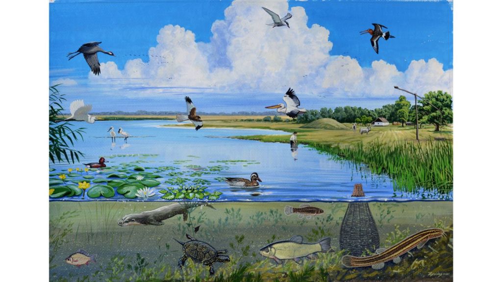
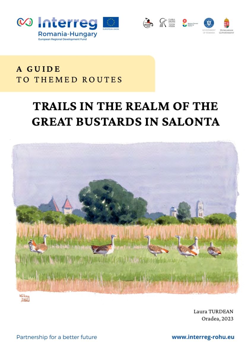
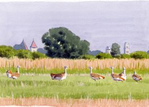
Cover photo: The natural landscape of Salonta, beginning of the 19th century (reconstruction) | © Márton Zsoldos.
Trails in the Realm of the Great Bustards in Salonta | Copyright © Milvus Transilvania Vest Association, 2023. All rights reserved. Data source: Google © 2023 CNES / Airbus | © Maxar Technologies | © Airbus
All data have been carefully inserted, yet we do not claim and cannot guarantee that these are unflawed. It was not possible to show all the roads, landmarks and points of interest on this map scale.
The Great Bustard in Romania
A timeline on the status of the Great Bustard on the territory of today’s RomaniaPublications
Dropia – Ghid educativ [RO] Túzok – Pedagógus kiadvány [HU] Drumeții în ținutul dropiilor de la Salonta - ghid rute tematice [RO] Trails in the Realm of the Great Bustards of Salonta - themed routes [EN] Kalandozások a túzokok birodalmában Nagyszalontán - túrakalauz [HU] Infographic on project results [EN] Infografic: rezultatele proiectului [RO] Infografika a projekteredményekről [HU]
Latest articles
29 June 2023
Find out more
Instead of drying out, it is a real oasis: a success story about the restoration of the Reed Lake - Nádas tó from Salonta
27 February 2023
Find out more
The realm of the Great Bustards is getting ready to welcome its visitors
Our project, launched in March 2018, has only a few more activities to complete until 30 June 2023, which will mark the end of the project.
18 June 2022
Find out more
Pioneering conservation measures in Romania applied in Salonta, Romania, for Great Bustards
Overhead power lines to us, humans, are a symbol of necessary infrastructure. But for the globally threatened Great Bustard, collisions with power lines can be fatal.
"Dropia" Community
You will get updates about our upcoming events or activities and you will have the latest news straight to your inbox